Monitoring company vehicles through satellite geolocation is a determining factor as it allows targeted control and coordination actions related to the use of the fleet, at any time.
In fact, thanks to the geolocation, achieved through the black box’s GPS component (72-channel Glonass multi-constellation), you can carry out a series of strategic activities to manage at best the fleet and the drives’ work, among which:
Have the history of the positions and routes travelled,
up to a maximum of 84 months
Receive notifications related to the entry/exit from points of interest
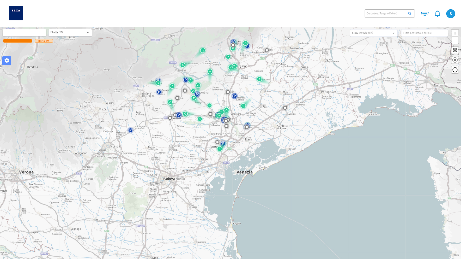
Know the real time digital map position accessible via web
(geographic coordinates and address)
Use the Geo-Fence alarms
This allows the following benefits:
- Check 24/7 in real time your fleet's movements on the territory, detecting possible discrepancies with company policies
- Check the use of the company vehicles in days and/or specific non-authorised timeslots (for example during the night or weekends)
- Measure the time a vehicle is stopped in specific points in the territory (for example workshops)
- Know the average level difference carried out by the vehicle
- Find out when the vehicles reach a specific point in the territory (for example customers, company branches, workshops, etc.)
- Check and optimise the routine routes carried out by the vehicles in the fleet
- Manage fines and accidents optimally